|
MapCatalog | Order | Support | SiteIndex | Contact | Home | ||||||||||
|
|
|
|
|
|
|
|||||||||||
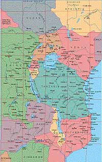
| Africa | 106 | |||||||||||||||

Mountain High Maps Catalog - East Africa, Kenya
Map Specifications for East Africa, Kenya
| Map identification: | 106 | Projection system: | Lambert's equal-area |
| Map coverage: | East Africa, Kenya | North boundary: | 10° 00' N |
| Image size (pixels): | 1,625 x 2,553 pixels | South boundary: | 19° 00' S |
| Image size (inches): | 5.42 x 8.51 inches | East boundary: | 42° 30' E |
| Image size (metric): | 138 x 216 millimeters | West boundary: | 23° 50' E |
| Resolution per pixel: | 1,200 meters | Horizontal scale: | 1:4,000,000 |
| RGB file size: | 12.0 Mb | Vertical scale: | 1:328,333 |
| CMYK file size: | 16.1 Mb | Vertical interval: | 100 meters |
| Grayscale file size: | 4.0 Mb | Vertical exaggeration: | 12.2 times normal |
|
Countries, states and territories: |
Burundi, Ethiopia, Kenya, Malawi, Mozambique, Rwanda, Sudan, Tanzania, Uganda, Zaire, Zambia, Zimbabwe, |
||
|
| ||
|
| ||
|
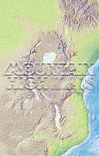
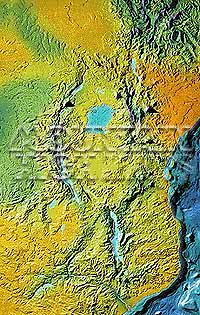
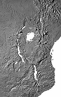
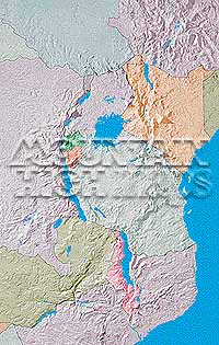
Top left: Elevation low-contrast relief rendering Top right: Vegetation high-contrast relief rendering Middle left: Grayscale land-only relief rendering Middle right: Political low-contrast relief rendering Lower right: Geo-political Illustrator EPS vector maps Inventory of maps and masks within each map portfolio
|
 |

| East Africa, Kenya and Tanzania Map #106 - Buying Options |
|
|
Vector only EPS map available for immediate download Complete East Africa, Kenya and Tanzania Relief and Vector Map Package for download |
|
© Digital Wisdom, Inc.