|
MapCatalog | Order | Support | SiteIndex | Contact | Home | ||||||||||
|
|
|
|
|
|
|
|||||||||||
| Asia | 309 | |||||||||||||||

Mountain High Maps Catalog - East Indies, Indonesia
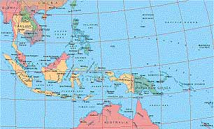
Map Specifications for East Indies, Indonesia
| Map identification: | 309 | Projection system: | Lambert zenithal equal-area |
| Map coverage: | East Indies, Indonesia | North boundary: | 26° 00' N |
| Image size (pixels): | 2,829 x 1,713 pixels | South boundary: | 22° 00' S |
| Image size (inches): | 9.43 x 5.71 inches | East boundary: | 170° 00' E |
| Image size (metric): | 240 x 145 millimeters | West boundary: | 93° 00' E |
| Resolution per pixel: | 3,000 meters | Horizontal scale: | 1:4,000,000 |
| RGB file size: | 13.8 Mb | Vertical scale: | 1:830,833 |
| CMYK file size: | 18.5 Mb | Vertical interval: | 250 meters |
| Grayscale file size: | 4.6 Mb | Vertical exaggeration: | 4.8 times normal |
|
Countries, states and territories: |
Australia, Brunei, Burma, Cambodia, China, Indonesia, Laos, Malaysia, New Caledonia, Papua New Guinea, Philippines, Solomon Islands, Taiwan, Thailand, Vanuatu, Vietnam, |
||
|
| ||
|
| ||
|
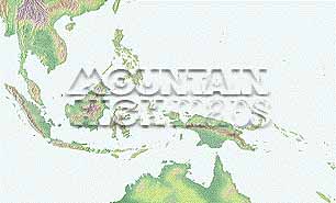
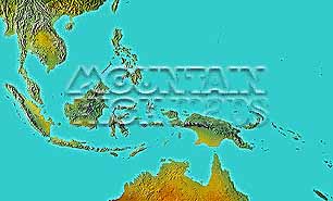
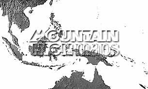
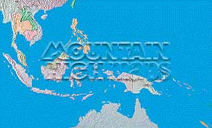
Top left: Elevation low-contrast relief rendering Top right: Vegetation high-contrast relief rendering Middle left: Grayscale land-only relief rendering Middle right: Political low-contrast relief rendering Lower right: Geo-political Illustrator EPS vector maps Inventory of maps and masks within each map portfolio
|
 |

| Indonesia Map #309 - Buying Options |
|
|
Vector only EPS map available for immediate download Complete Indonesia Relief and Vector Map Package for download |
|
© Digital Wisdom, Inc.