|
MapCatalog | Order | Support | SiteIndex | Contact | Home | ||||||||||
|
|
|
|
|
|
|
|||||||||||
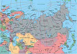
| Asia | 310 | |||||||||||||||

Mountain High Maps Catalog - Russia and former U.S.S.R.
Map Specifications for Russia and former U.S.S.R.
| Map identification: | 310 | Projection system: | Lambert's equal-area |
| Map coverage: | Russia and former U.S.S.R. | North boundary: | 60° 00' to 90° 00' N |
| Image size (pixels): | 2,863 x 2,023 pixels | South boundary: | 24° 00' to 30° 00' N |
| Image size (inches): | 9.54 x 6.74 inches | East boundary: | 160° 00' W to 140° 00' E |
| Image size (metric): | 242 x 171 millimeters | West boundary: | 20° 00' W to 40° 00' E |
| Resolution per pixel: | 3,300 meters | Horizontal scale: | 1:15,000,000 |
| RGB file size: | 16.5 Mb | Vertical scale: | 1:820,833 |
| CMYK file size: | 22.1 Mb | Vertical interval: | 250 meters |
| Grayscale file size: | 5.5 Mb | Vertical exaggeration: | 18.3 times normal |
|
Countries, states and territories: |
Afghanistan, Armenia, Austria, Azerbaijan, Belgium, Belorussia, Bulgaria, China, Croatia, Cyprus, Czech Republic, Denmark, Estonia, Finland, France, Georgia, Germany, Hungary, Iran, Iraq, Ireland, Israel, Japan, Jordan, Kazakhstan, Kuwait, Kyrgyzstan, Latvia, Lebanon, Lithuania, Luxembourg, Moldova, Mongolia, Nagomo, Karabakh, Netherlands, North Korea, Norway, Pakistan, Poland, Romania, Russia, Saudi Arabia, Slovak Republic, Slovenia, South Korea, Sweden, Syria, Tajikistan, Turkey, Turkmenistan, Ukraine, United Kingdom, Uzbekistan, Yugoslvia |
||
|
| ||
|
| ||
|
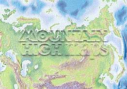
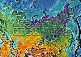
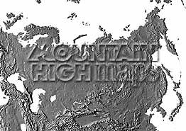
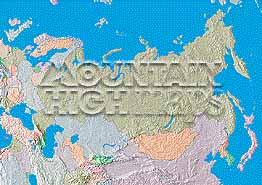
Top left: Elevation low-contrast relief rendering Top right: Vegetation high-contrast relief rendering Middle left: Grayscale land-only relief rendering Middle right: Political low-contrast relief rendering Lower right: Geo-political Illustrator EPS vector maps Inventory of maps and masks within each map portfolio
|
 |

| Russia Map #310 - Buying Options |
|
|
Vector only EPS map available for immediate download Complete World Relief and Vector Map Package for download |
|
© Digital Wisdom, Inc.