|
MapCatalog | Order | Support | SiteIndex | Contact | Home | ||||||||||
|
|
|
|
|
|
|
|||||||||||
| Europe | Brit. Isles | 504 | ||||||||||||||

Mountain High Maps Catalog - Iberia, Spain, Portugal
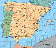
Map Specifications for Iberia, Spain, Portugal
| Map identification: | 504 | Projection system: | International |
| Map coverage: | Iberia, Spain, Portugal | North boundary: | 44° 00' N |
| Image size (pixels): | 2,457 x 2,105 pixels | South boundary: | 35° 00' N |
| Image size (inches): | 8.19 x 7.02 inches | East boundary: | 04° 30' E |
| Image size (metric): | 208 x 178 millimeters | West boundary: | 10° 00' E |
| Resolution per pixel: | 500 meters | Horizontal scale: | 1:1,000,000 |
| RGB file size: | 14.7 Mb | Vertical scale: | 1:100,000 |
| CMYK file size: | 19.7 Mb | Vertical interval: | 30 meters |
| Grayscale file size: | 4.9 Mb | Vertical exaggeration: | 10.0 times normal |
|
Countries, states and territories: |
Algeria, Andorra, France, Morocco, Portugal, Spain, |
||
|
| ||
|
| ||
|
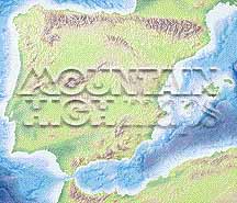
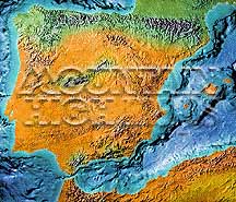
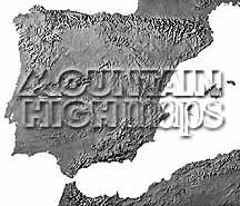
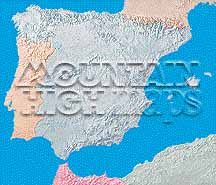
Top left: Elevation low-contrast relief rendering Top right: Vegetation high-contrast relief rendering Middle left: Grayscale land-only relief rendering Middle right: Political low-contrast relief rendering Lower right: Geo-political Illustrator EPS vector maps Inventory of maps and masks within each map portfolio
|
 |

| Spain & Portugal Map #504 - Buying Options |
|
|
Vector only EPS map available for immediate download Complete Spain & Portugal Relief and Vector Map Package for download |
|
© Digital Wisdom, Inc.